+968 97 235 282
info@alfawaztours.com
Frankincense was highly priced and it was one of the most important trade in the ancient and medieval period. Remnants of the glorious days of frankincense trade in southern Salalah are still present and some of the places are declared as UNESCO world heritage sites. The frankincense trees of Wadi Dawkah and the remains of the caravan oasis of Shisr/Wubar and the affiliated ports of Khor Rori and Al-Baleed vividly illustrate the trade in frankincense that flourished in this region for many centuries.
Location: 17.009591, 54.135616
Opening hours: Sun – Thu 09:00 – 21:00 | Fri – Sat 15:00 – 21:00
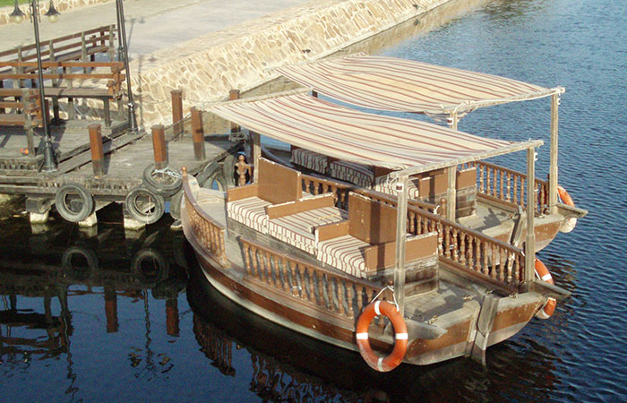
Al-Baleed, a harbor directly placed on the beaches of the Indian Ocean with a lagoon behind it, is the historically late name for the town. Artifacts from China (Ming) and other countries indicate its importance as a harbor along the ´Silk Road to the Sea´ from where, in exchange, frankincense was also traded. Though heavily fortified, the town was attacked and partially destroyed on several occasions in the 13th century. By the late 15th century, radical changes to trading patterns imposed by Portuguese and other European trading nations sealed the fate of the town.
Location: 17.001526, 54.101054
Opening hours: Sat – Thu 09:30 – 13:00 & 16:00 – 22:00 | Fri 16:00 – 22:00
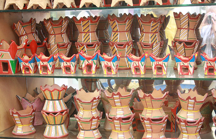
Haffah souq (also known as Al Husn Souk) is one of the most interesting traditional souqs with small shops, particularly famous for selling frankincense and other types of perfumes such as Bakoor and attar. All the different qualities of frankincense and its products can be found in these shops and this is the best place to buy frankincense products. One can enjoy the atmosphere while sitting at a restaurant and having some traditional dishes. Many of the stalls selling aromatics are run by veiled female traders.
Location: 16.988948, 54.692249
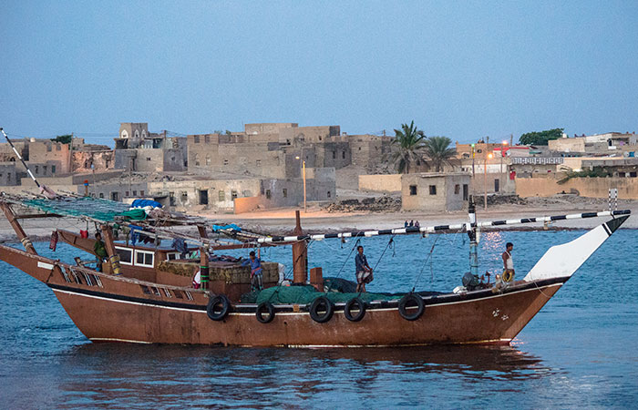
Mirbat is a coastal fishing town in south Oman. It is located about 80km east of Salalah. Mirbat (Moscha) was involved in the export of frankincense in ancient times, to places as far as China. Ruins of an old city with well-built merchant houses are still to be seen including some other important archaeological sites around the town such as, Bin Ali’s tomb, an ancient graveyard and an old fort.
Location: 17.040186, 54.434029
Opening hours: Sat – Fri 08:00 – 17:00
The port of Khor Rori (the Moscha Limen) lies 40km to the east of Salalah. About 400m from the open sea, it dominates the lagoon which opens to the sea and served as a natural harbour. The remains of the fortress are still evident. The walls have dressed stone faces with rubble cores. The port was refounded at the end of the 1st century by LL’ad Yalutas (evidenced by an inscription still in situ) to control the trade in Dhofar incense. It was the hub of the trading settlements on this coast at that time. The process of disintegration began in the 5th century.
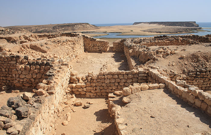
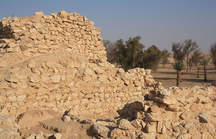
Location: 18.255194, 53.647956
Opening hours: Sat – Fri 08:00 – 18:00
Shisr lies about 180km north of Salalah in the desert of Rub al Khali. This agricultural oasis and caravan site was a very important station also for water supply on the routes from the Nejd and the hinterland from where frankincense was brought to the ports along the coast. Atlantis of the Sands is the fictional name of a legendary lost city in Shisr, claimed to have been destroyed by a natural disaster or as a punishment by God. The search for it was popularised by the 1992 book Atlantis of the Sands – The Search for the Lost City of Ubar by Ranulph Fiennes.
Location: 17.338719, 54.076892
Wadi Dawkah is a major place where the frankincense tree (boswellia sacra) can still be found and frankincense is harvested to this day. The wadi seasonally drains the north-south Mountains disappearing into the desert of the ´Empty Quarter´, the Rub al Khali. The trees grow in the alluvial bed of the wadi under the extreme heat of this region.
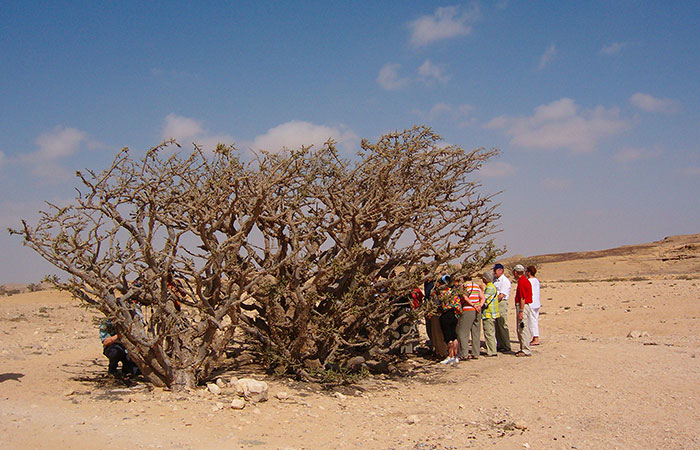
Location: 22.983333, 57.533333
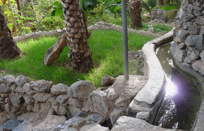
The Aflaj Irrigation Systems of Oman are ancient water channels from 500 AD located in the regions of Dakhiliyah, Sharqiyah and Batinah. However, they represent a type of irrigation system as old as 5000 years in the region named as Qanat or Kariz as originally named in Persia.
Aflaj irrigation system effectively divided the water among all the inhabitants; it flowed by gravity from their original sources to homes and cropland. In 2006, five Aflaj Irrigation Systems of Oman were added to the UNESCO list of World Heritage Sites: Falaj Al-Khatmeen, Falaj Al-Malki, Falaj Daris, Falaj Al-Mayassar and Falaj Al-Jeela.
Location: 23.274099, 56.747715 / 23.216169, 56.962182
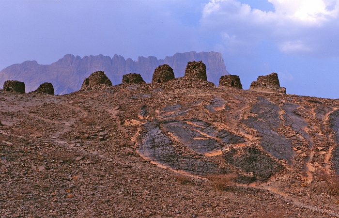
The protohistoric site of Qubur Juhhal at Al Ayn lies near a palm grove in the interior of the Sultanate of Oman. Together with the neighbouring sites, it forms the most complete collection of settlements and necropolises from the 3rd millennium B.C. in the world. The 21 tombs, aligned on a rocky crest that stands out in the superb mountainous landscape of Jebel Misht to the north, are in a remarkable state of preservation. They have not been excavated and constitute an obviously interesting archaeological reserve. The tomb complex is under the UNESCO world heritage protection.
Location: 17.009591, 54.135616
Opening hours: Sun – Thu 09:00 – 21:00 | Fri – Sat 15:00 – 21:00
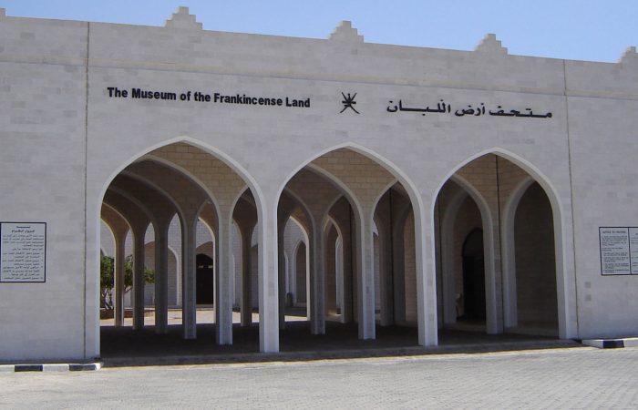
The Al Baleed Museum (The Land of Frankincense Museum) is located in Salalah. It is opened in July 2007 at Al Balid Archaeological Park (UNESCO).
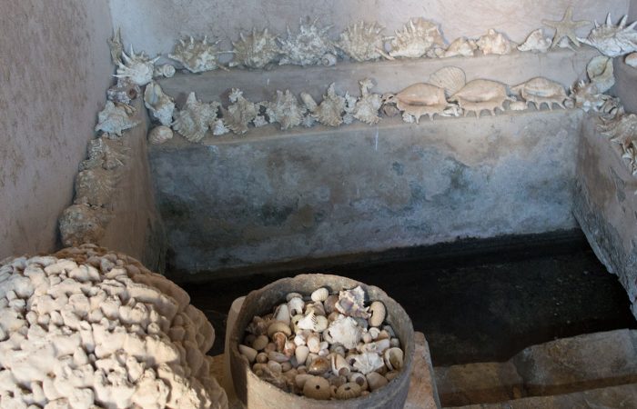
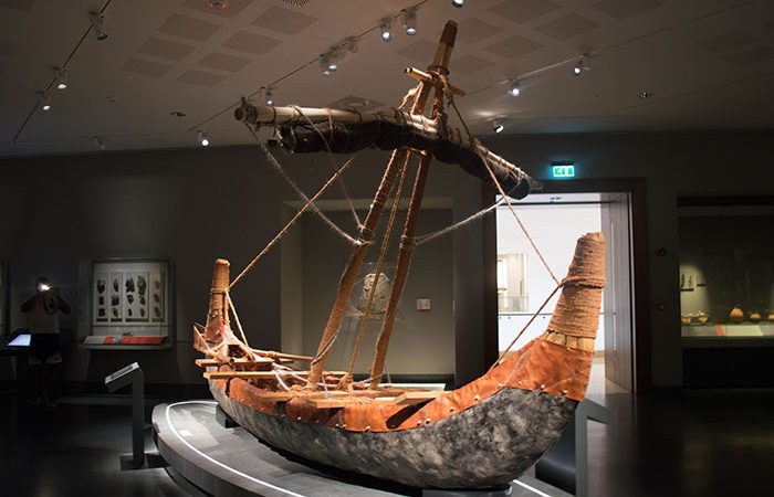
It houses two main halls, namely the History Hall, depicting the geography, history of the ancient Frankincense trail and the historical background of the Sultanate through a number of archaeological findings, and The Marine Hall, featuring displays about the development of Oman’s rich marine history. A complete history of the Maritime trade & ship building industry of Oman could be experienced here, with meticulously carved replicas of the ancient boats & ships of the Omani Maritime trade.
Location: 23.120047, 57.282069
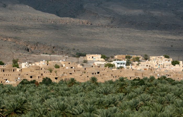
Al Hamra is a 400-year-old town in the region Ad Dakhiliyah, in northeastern Oman. The town and province lie on the southern slopes of the Akhdar Mountains.
Al Hamra is also known as Hamra Al Abryeen with reference to the Al Abri tribe who live there. Near the center of the town is a plaza and the souq. Some of the oldest preserved houses in Oman can be found in Al Hamra, a town built on a tilted rock slab. Many of the houses have two, three and even four stories, with ceilings made of palm beams and fronds topped by mud and straw. Visitors to the nearby souq can watch a halwa maker at work in the only halwa shop still operating in the old souq.
Location: 22.217178, 59.202802
Opening hours: Sat – Fri 09:00 – 18:00
The museum is located at the Old Castle of Al Kamil. The Castle was built in the 17th century while the museum was established in 2012 after the completion of the castle restoration. Falaj Al- Kamil, an ancient falaj passes inside this ancient Castle. More than ten thousand ancient artifacts from a private collection are displayed in this museum. It contains pieces of old ceramic, old copper, metals, old tools, electronics and old machineries. Additionally, it displays palm leaves craft works, traditional wooden boxes, and various potteries. Furthermore, the museum displays traditional textiles, old leathers, glass, silverware, guns, swords, daggers, coins, paper notes, stamps and old books and magazines.
Location: 23.614362, 58.589366
Opening hours: Sat – Thu 09:30 – 18:00
Bait Al Zubair museum is a famous museum in Muscat and has an extensive collection of ancient weapons, including khanjar, household equipment and costumes from a private collection of Zubair family. Outside the museum is a model of a full-scale Omani village and souk.
Location: 22.696808, 59.372982
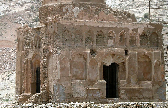
Bibi Mariam Mausoleum is located on the Omani coast south of Muscat near the medieval city of Qalhat. The city was described by Marco Polo and visited by Ibn Battuta in the second quarter of the 14th century. Qalhat served as an important stop in the wider Indian Ocean trade network, and was also the second city of the Kingdom of Hormuz.
This Mausoleum was built for Baha al-Din Ayaz, successor Mahmud b. Ahmad al-Qusi al-Qalhati the founder of the Hormuz Empire, which flourished in the 8th – 14th century. The mausoleum was built by his wife of Baha al-Din Maryam, thus it is called the Bibi Mariam mausoleum. Ibn Battuta describes a Congregational Mosque in Qalhat, which some scholars think he confused with the Bibi Mariam mausoleum.
Location: 23.192052, 57.387481
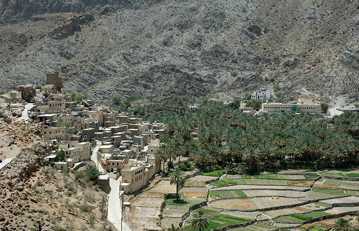
Balad Sayt is a mountain village, and located on the northeast slope of the Al Hajar Mountains near the highest peak in the Sultanate of Oman, Jebel Shams. Balad Sayt can be reached through Wadi Al Sahtan and Wadi Bani Awf from northeast or via Al Hamra from the southwest and is only accessible by 4-wheel-drive vehicles. Balad Sayat is a stunning village in picturesque surroundings that should be part of anyone’s checklist of places to visit when coming to Oman.
Location: 22.926678, 57.682887
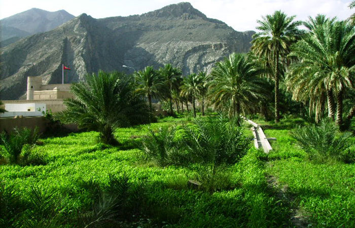
Birkat Al-Mawz is a pretty village, located at the entrance of Wadi al-Muaydin on the southern rim of Jebel Akhdar. The village has conserved its old charm and serves its visitors some interesting insights. It is home to an old fort, an active falaj (irrigation channel), some interesting old buildings and a lush green plantation of date palms and bananas, which the name of the village apparently derived from (Banana pool). A road and a walking route through Wadi al-Muaydin up to the Saiq Plateau start from here.
Location: 23.583937, 58.391424
Opening hours: Sat – Thu 08:00 – 11:00
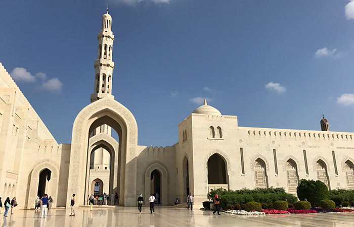
The Sultan Qaboos Grand Mosque is the main mosque in the Sultanate of Oman, located in the capital city of Muscat. The construction of the Mosque took six years and seven months and opened in 2001 to celebrate 30 years of HM the Sultan Qaboos reign. The Mosque has a total capacity of up to 20,000 worshipers.
A major feature of the design of the interior is the prayer carpet, which contains, 1,700,000,000 knots, weighs 21 tons and took four years to produce, and covers the 4,343 m2 area. The chandelier above the praying hall is 14m (46 feet) tall and was manufactured by the Italian company Faustig.
Location: 17.111272, 53.994409
Opening hours: Sat – Thu 08:00 – 18:00 | Fri 08:00 – 12:30 & 14:00 – 18:00
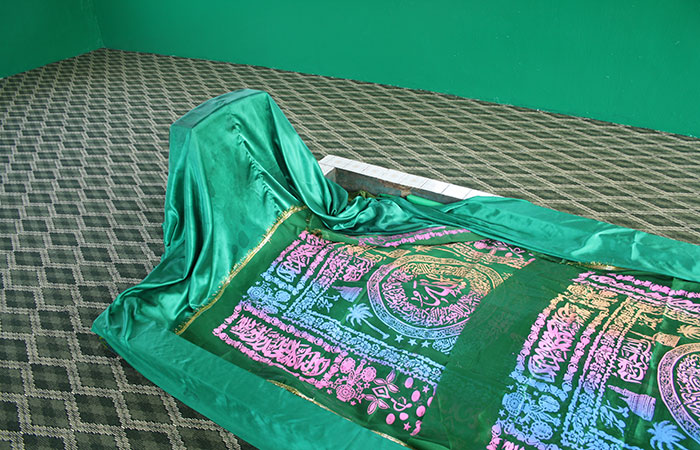
The Tomb of Job is one of the alleged burial sites of Job from the Old Testament. It is located on the Qara Mountains overlooking the city of Salalah in Dhofar region. There is a mosque and tomb where the remains of the prophet are located. There is a small garden to walk through to get to the tomb, which is housed in a small building. Immediately next to the tomb are the walls of a small room used for prayer. Though his life is also pre-Judaism, even at that time he believed in the Oneness of God. The tomb itself is roughly 6 meters long. Visitors regularly offer incense and other gifts out of respect for the prophet.
Location: 23.140667, 57.310668
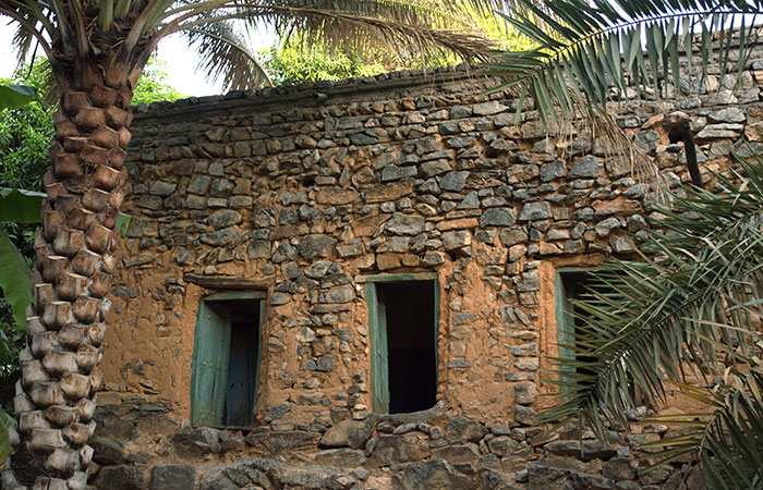
Misfat Al Abriyeen is a beautiful mountainous village located on the foothills of Jebel Akhdar near to Al Hamra. The ancient tribe of Al Abri created the settlements in the area, thus the Name of the village derived from their name.
Misfat Al Abriyeen is a popular tourist destination as it offers its visitors amazing agricultural terraces and beautiful alleys. The old houses built on top of solid rocks are traditional mud houses with palm frond roofs. Villagers grow bananas, pomegranates, papayas, mangoes, citrus trees and date palms on terraces, which are watered through an intricate falaj system that has been carved through the hard rocks of the mountain.
Location: 23.588563, 58.407947
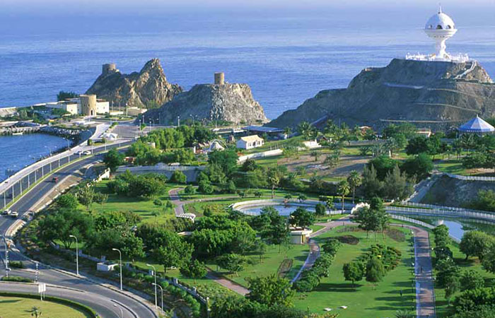
Muscat is the capital and largest city of Oman. The city lies on the Arabian Sea along the Gulf of Oman and is in the proximity of the strategic Straits of Hormuz. The rocky Western Al Hajar Mountains dominate the landscape of Muscat. The total population of Muscat Governorate is 1.4 million. Muscat is known since the early 1st century as an important trading port between the west and the east. Muscat is renowned as one of the cleanest Arab capitals. Breathtaking intermingling of ancient cultural heritage and modern style is that, what is striking about Muscat.
Location: 23.612182, 58.593610
Opening hours: Sat – Thu 10:00 – 17:00 | Fri 14:00 – 18:00
The National Museum of the Sultanate of Oman, established by royal decree and opened July 30, 2016, is the Sultanate’s flagship cultural institution, showcasing the nation’s heritage from the earliest human settlement in the Oman Peninsula some two million years ago through to the present day. The museum is located in the heart of Muscat in a purpose-designed building. The total area of the building is 13,700 m2 (147,000 sq ft), including 4,000 m2 (43,000 sq ft) allocated for 14 permanent galleries.

Location: 23.598883, 58.422366
Opening hours: Sun – Thu 09:00 – 13:30 | Sat 09:00 – 13:00
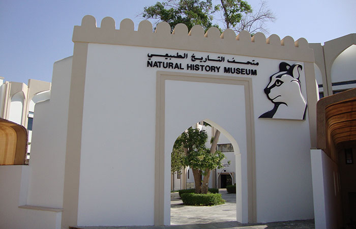
The Natural History Museum of Oman is is located at the Ministry of Heritage and Culture complex, Al Khuwair, opposite the Zawawi Mosque in Muscat. The museum is opened in 1985, and has detailed coverage of Oman’s flora and fauna, with displays on indigenous mammals, insects, and birds and botanical gardens. One of the highlights of the museum is the whale hall: it houses the huge skeleton of a sperm whale, which was washed up on the Omani coastline in the 1986.The museum contains marine and animal fossils, ancient mammals, and stuffed animals.
Location: 17.025220, 54.112584
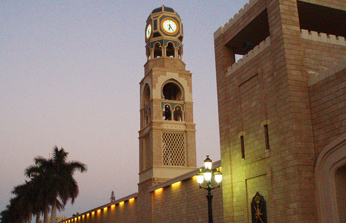
Salalah is the second-largest city in the Sultanate of Oman, and the largest city in the southern province of Dhofar. Salalah is the birthplace of the current sultan Qaboos bin Said. Salalah attracts many people from other parts of Oman and the Persian Gulf region during the monsoon (khareef) season, which spans from July to September. The climate of the region and the monsoon allows the city to grow some vegetables and fruits like coconut and bananas. There are many natural and historical attractions in and around the city of Salalah. Second international airport of the country is located in Salalah, as Salalah considered as the tourism capital of Oman.
Location: 17.017759, 54.093950
Opening hours: Sat – Thu 08:00 – 11:00
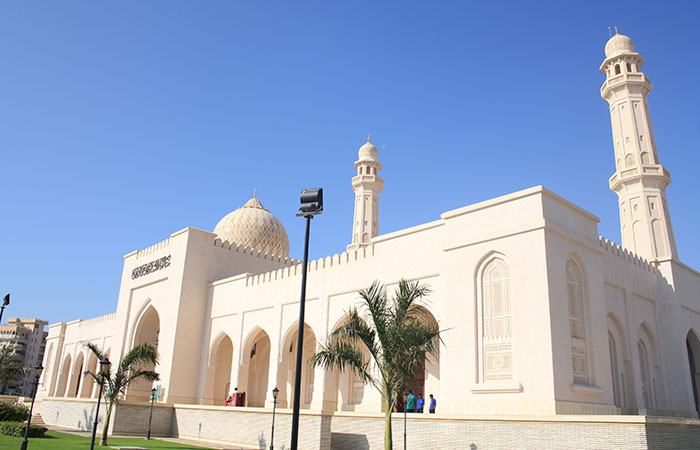
Sultan Qaboos mosque is located in the center of the city and it is the largest mosque in Salalah since 2011. The mosque is definitely an inspired place of worship that is worth a visit if you are in Salalah. Inside the mosque, the prayer hall is beautifully decorated with crystal chandeliers, hand-woven carpets in shades of green and patterned walls.
Location: 22.563804, 59.540030
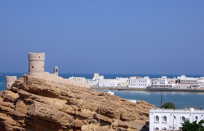
Sur is a city on the coast of the Gulf of Oman. It is located about 150km southeast of the capital Muscat. Historically, the city is known for being an important destination point for sailors. By the 6th century, Sur was an established centre for trade with East Africa. Today, the sea still plays an important part of life in Sur. It is one of the famous cities in the Gulf region in building wooden ships. Its historical location gives it the hand to monitor the Gulf of Oman and the Indian Ocean. Many ships have been built in this city, which formerly went as far as China, India, Zanzibar, Iraq and many other countries. These vessels were also used in pearl fishing.
Location: 23.051241, 57.467788
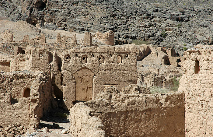
Tanuf is located at the backdrops of Hajar Mountains, between Nizwa and Bahla. This tiny village is famous for its plantations and the ruins of its former settlement, which was destroyed by the jebel Akhdar war in 1950s. These ruins and the romantic atmosphere attract many photographers and history lovers.
Location: Al Kharijiyah Street, Muscat 113, Oman [23.613863, 58.467378]
Opening hours: Saturday to Thursday: 08:30 – 17:30
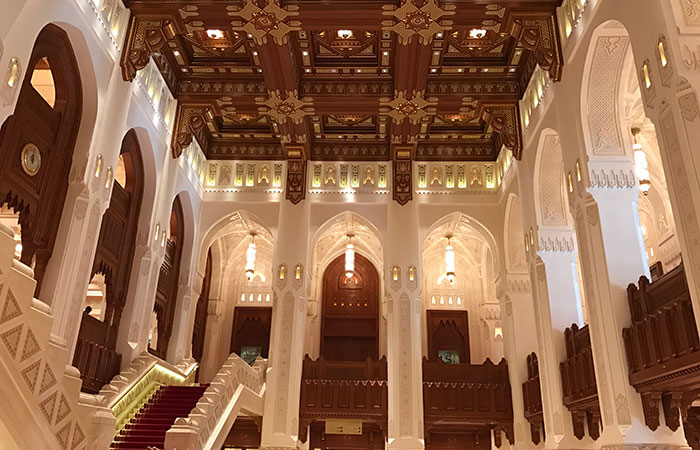
The Royal Opera House Muscat (ROHM) is Oman’s premier venue for musical arts and culture. Built on the royal orders of His Majesty the Sultan Qaboos of Oman, the Royal Opera House reflects unique contemporary Omani architecture, and has a capacity to accommodate maximum of 1,100 people. The opera house complex consists of a concert theatre, auditorium, formal landscaped gardens, cultural market with retail, luxury restaurants and an art centre for musical, theatrical and operatic productions.
Location: 23.140087, 57.735203
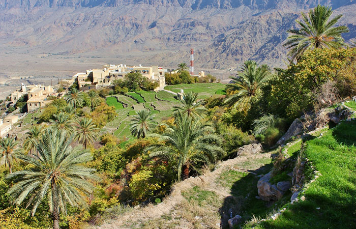
Wakan village is located about 2000m above sea level in the Western Hajar Mountains, ca. 150km from Muscat. It is a small mountain village with beautiful terraced gardens overlooking the surrounding mountains above and Wadi Mistal below. The terraced gardens are used to cultivate different agricultural products such as pomegranates, apricots and grapes. One can explore the area by foot and there are few hiking tracks starting from the village.
Location: 16.707920, 53.259657 (Babobab tree)
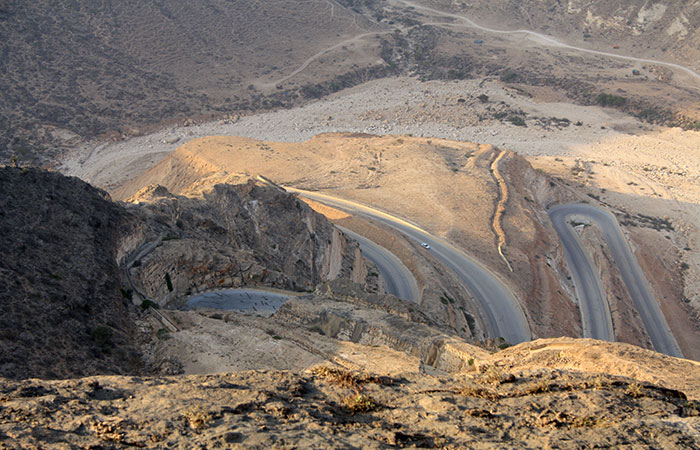
West Salalah, the mountain terrain of Jebel al Qamar is another spectacular landscape. There are numerous places to visit including the scenic Fizaya beach, and Dalkut fishing village, one of the most remote villages at the western border. Do not forget to admire the astonishing landscapes along the famous hair-pin-bend road on the way to Fizaya and Dalkut.
